Geological Resources
Knowledge of the seabed is important for ocean energy installations, as well as for a range of economic activities in shelf seas (e.g. fisheries, navigation, cable laying). The economic importance of such knowledge is recognised at the highest level of EU marine science policy; however, available high resolution data on the seabed, particularly with respect to its temporal variability, are limited in Welsh waters.
Within SEACAMS we have a team of geological oceanographers who have the expertise and knowledge base to assess the seabed and coastal environments. The SEACAMS research effort is directed towards developing knowledge on a regional scale in order to develop scientific understanding of how the inner continental shelf works on a range of time scales. The group is equipped with a range of geophysical equipment including multibeam sonars on the RV Prince Madog and small boats, side scan sonar, and high resolution sub-bottom profilers. Recent and ongoing research projects conducted by this group include:
- Development of optimal observational strategies for seabed characterisation on regional scales
- Assessment of localised seabed properties in broader regional and geological contexts
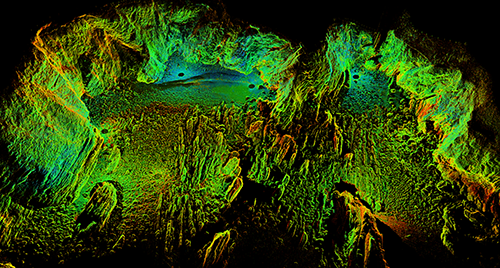
- Reconstruction of seabed history from seabed morphology (sonar) and sub-bottom geometry (sub-bottom profiling)
- Linkage of acoustic (sonar) data and optical (video) data for characterisation of biological habitats
- Provision of seabed data to underpin ecological modelling of the seabed
- Assessment of multibeam and side scan sonar methodologies for seabed characterisation
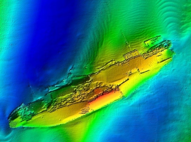
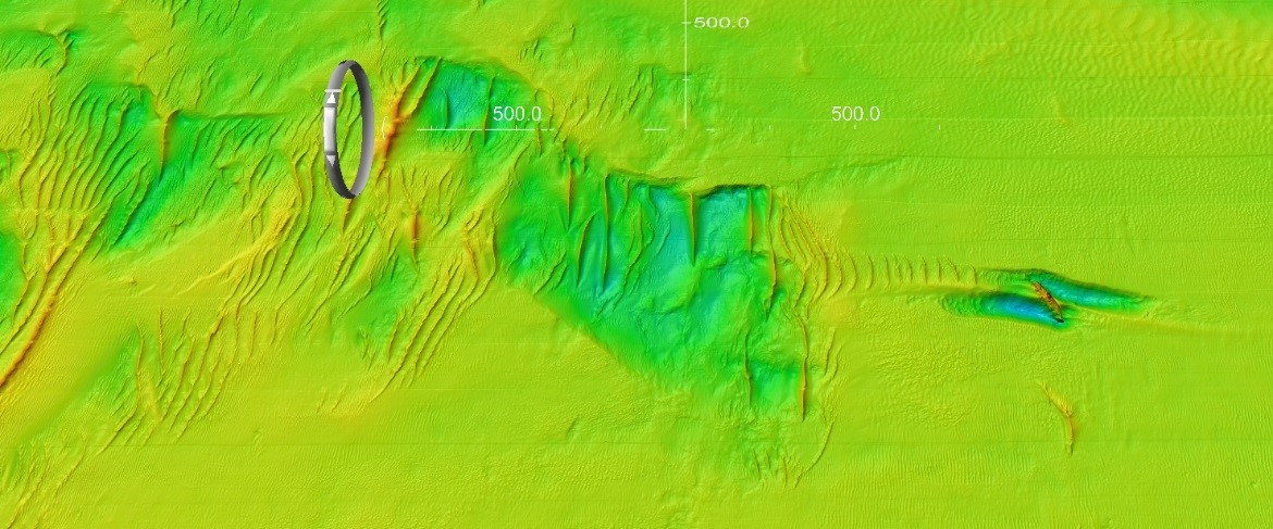
- Use of shipwrecks to quantify the impacts of large structures on the seabed under a wide range of water depths and hydrodynamic conditions.
Please get in contact with us if you would like to know more about our capabilities or collaborate on R&D projects.